Impacts of El Nino and La Nina
Initial Publication Date: May 31, 2013 | Reviewed: July 12, 2015
Summary
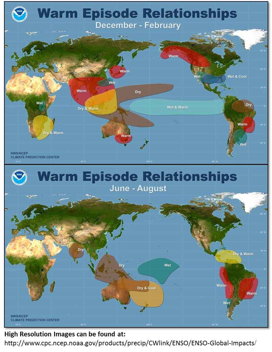
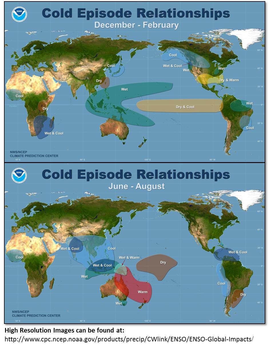
In this exercise, students explore NOAA and the Climate Data Center websites that provide information about El Niño. The students are then asked interpret a series of maps to describe the key changes in climate conditions during El Niño and La Niña. Two locations of emphasized: North America and Australia to illustrate the contrast in climatic changes and allow for determination of the impacts close to home.
Context
Audience
undergraduate course for non-science majors
Skills and concepts that students must have mastered
familiarity with web-browsing software
How the activity is situated in the course
This activity can be assigned as a stand alone homework or as an in-class activity if computers are available.
Goals
Content/concepts goals for this activity
- El Nino & La Nino
- Atmospheric Circulation sea surface temperature patterns in equatorial Pacific
- Climate Impact
Higher order thinking skills goals for this activity
- interpret graphical information
- synthesize data to draw conclusions
Other skills goals for this activity
Description and Teaching Materials
Teaching Notes and Tips
Assessment
Since the exercise is a series of questions based on reading and interpretation of maps, a simple rubric can be applied.